Queens Canyon

Date: 1/16/2012
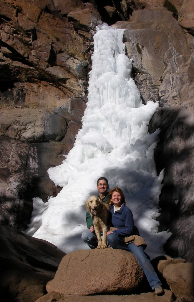
Who: Michelle, Sammy and myself
Length: about 2 miles (1 in + 1 back)
Time: 2.75 hours
Weather: 50 degrees, sunny

Most of this trail is on private property, on the grounds of Glen Eyrie. To hike it is necessary to make reservations in advance, sign waivers, show your paperwork and ID at the gate, and follow their rules. See their web site for details. One of my maps shows the Queens Canyon trail goes all the way to Rampart Range Road, meeting the road not far from the Williams Canyon trail. (We did not go up that far.)

Queens Canyon is narrow, and the trail criss-crosses the stream like mad. Today’s conditions were that the trail was dry, packed snow and icy in various spots. The stream was frozen-over in some sections, and free-flowing in others. It made for a tricky, technical hike up to the falls. The requirement to have Sammy on-leash added another dimension to the tricky-technicalness. I think the hike would be better in the Summer, when it is warmer so you don’t care if your feet get wet, and then just have fun. It is a very pretty canyon–I would definitely come back in the Summer with swimming in mind.

Poor little Sammy had a tough outing: I stepped on her paw once with one of my spikes (not bad, no blood). She had to be on-leash the whole time. So, I was correcting her quite often verbally, and with the leash, to direct her in the desired direction. And, she had a bad encounter with a mean dog, to boot (a little scary, but also no blood)!


View Colorado Chris Hikes in a larger map

Nelson Camp

Date: 1/15/2012
Who: Sammy and myself
Length: about 9 miles
Time: 6 hours
Weather: 50 degrees, overcast, breezy

I spent several hours on Saturday exploring the trails in North Cheyenne Canyon. Sammy and I returned to Seven Bridges trail and Jones Park. In Jones Park we took forest trail 720 in a northerly direction for awhile, then turned around and took forest trail 668 to a location called Nelson Camp on the map. Whatever it may have been at one time, there is not much left of Nelson Camp. I saw only the remnants of two small log structures. I Googled around for some information on the history of Nelson Camp but found none. Now I am even more curious.

I was hopeful for a day of great conditions, with a forecast of highs in the 50s. But, was a little bummed by the overcast clouds all day. My feet got wet from snow melt through my hiking shoes. I was wearing low-cut summer-type hiking shoes with gaiters and microspikes. The snow tended to collect right on the top of my toes and melt there. Another disappointment was that I lost my camera. Thus, no photos or video today. Dang!

Note to self: grapefruit wedges make a great trail snack!

One of my reasons behind today’s hike was to explore possible hiking routes from North Cheyenne Canyon Park, up to the peak of Almagre Mountain (12,367′). It is in my mind to do that one day. I believe that the north route is probably more advantageous–going through Jones Park on trail 720, then directly west along the north slope of Runs-Down-Fast Mountain and up to Almagre.

Another long hike to consider is a loop from North Cheyenne Canyon park up Seven Bridges, to Nelson Camp, to Frosty’s Park, up Mount Rosa (11,499′), then down through Buffalo Canyon and St. Mary’s Falls back to North Cheyenne Canyon park. That would be a long one, but do-able in a full day.

Update on 1/23/2012: Thanks to Annette from New Hampshire, my lost camera is returned! Added video and photos to the post…


This hike followed the RED line:

View Colorado Chris Hikes in a larger map

Mount Herman

Date: 1/14/2012
Who: Sammy and myself
Length: 2.6 miles (1.3 out + 1.3 back)
Time: 1.75 hours
Weather: 50 degrees, sunny, breezy at the top

This is a hike up Forest Service trail 716 to the top of Mt. Herman, west of Monument, Colorado. It is a short hike that gains about 1000′ elevation in 1.3 miles. From the top one can see north to Denver, south to Colorado Springs and beyond. The trail goes up the west slope of Mt. Herman. The trail is tucked into a well-treed valley, and it was covered in packed snow and ice all the way up. The Kahtoola microspikes were practically essential today. Two wind socks at the summit are apparently there for the benefit of paragliders.

Today’s hike was punctuated throughout by echoing shots from firearms. Gun owners use several areas in the nearby national forest as ad-hoc shooting ranges. After the hike, I drove further west on Mt. Herman Road to investigate. I encountered about 8 different groups of gun enthusiasts along the way. I stopped to watch them target practice at a couple of sites. The Pike National Forest is truly a “land of many uses”. Shortly after leaving the area where it is legal to fire firearms, I came across a family who were enjoying a sledding hill. What a contrast.

View Colorado Chris Hikes in a larger map